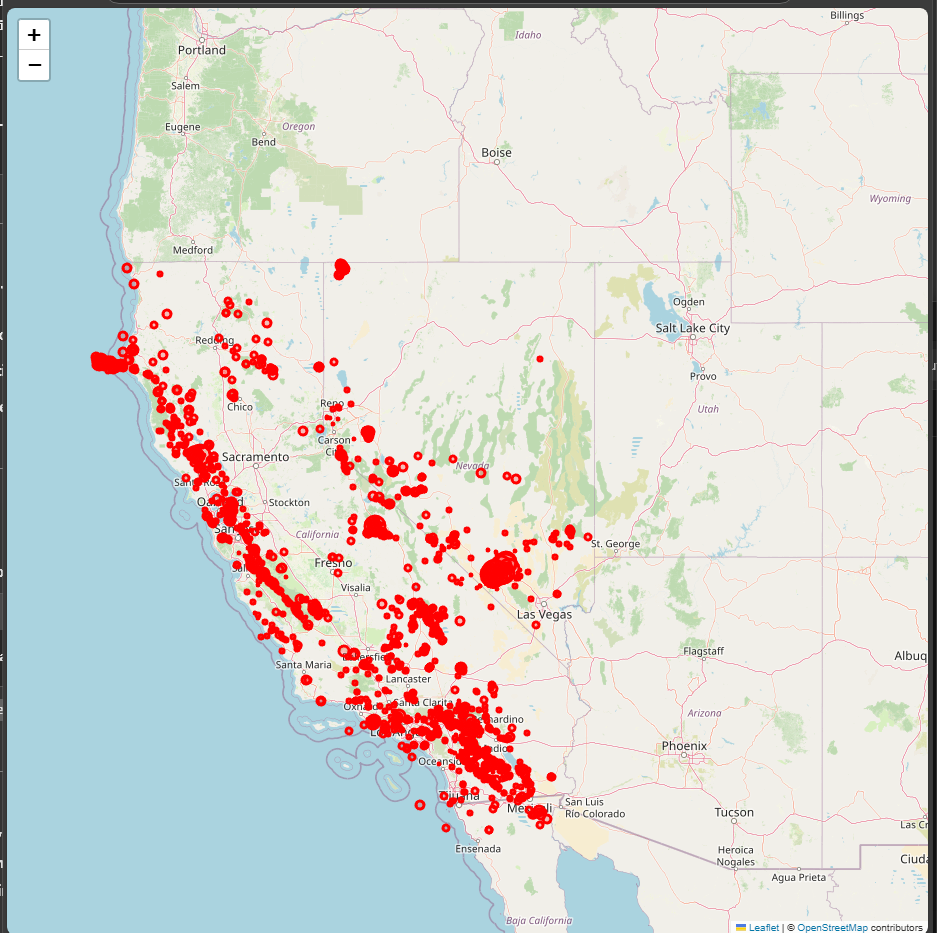
Earthquake Explorer
An app that collects and visualizes earthquake data from the USGS API.
- Automated data collection with Python
- Storage using PostgreSQL
- Interactive maps built with Streamlit and Leaflet
Exploring technology through design and data
Hi. I build practical tools and clean interfaces. I like data, clarity, and quiet polish.
An app that collects and visualizes earthquake data from the USGS API.
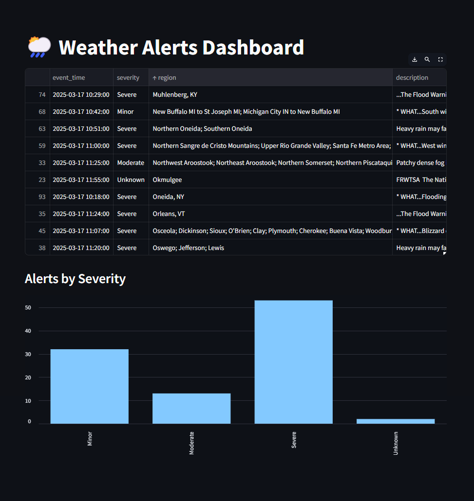
An app fetching and visualizing active weather alerts from the NWS API.
Prototype for ingesting, processing, and displaying real-time environmental data.
Processing satellite data for insights on climate and natural events.
Start and whack the mole when it pops up.